Williams P-2335
General information | |
| Waterway |
Kennebec River |
| Current status | Active license |
| Type of facility | Conventional Hydro |
| Mode of hydropower generation | Reregulating |
| Type of permit | FERC License |
FERC information | |
| FERC docket # | P-2335 |
| FERC project name | Williams |
| Permit issued | 10/29/17 |
| Permit expiration | 4/26/54 |
Ownership and operation | |
| Owner | Brookfield White Pine Hydro, LLC. |
| Owner type | Wholesale Power Marketer |
| Year first online (conventional hydro) | 1939 |
| Transmission or distribution system owner | Central Maine Power Co |
Power and generating capacity | |
| Number of units | 2 |
| Total capacity from hydraulic turbine-generator units within each plant | 13.0 MW |
| Average annual net hydropower generation | 93,045.2 MWH |
FPL Energy (the licensee) is seeking to renew the license for this project which expires in 2017 and has recently started the licensing process with the filing of Notice of Intent to File a License Application (NOI) and a Pre-Application Document (PAD).
The Williams Project is located on the Kennebec River, approximately 1 mile northwest of Solon in Somerset County, Maine. The project consists of an existing 45-foot-high, 904.29-foot-long dam including an integral powerhouse with a total installed capacity of 13 megawatts (MW). The project operates in a store and release mode to regulate downstream flows and meet peak demands for hydroelectric generation. The average annual generation of the Williams Project is 92,866 megawatt-hours.
The existing Williams Project consists of:
(1) a 904.29-foot-long, 45-foot-high dam that includes: a 243.50-foot-long gated spillway section with five tainter gates, one vertical lift wheel gate, and a crest elevation of 300 feet United States Geological Service (USGS) datum; a 202.00-foot-long earthen embankment section with a concrete core at the east end of the spillway; a 71.33-foot-long abutment section at the west end of the spillway; a 203.33-foot-long stanchion bay section at the west end of the abutment; a 51.63-foot-long bulkhead section with a tainter gate, a deep gate, and a sluice way at the west end of the stanchion; a 105.50-foot-long intake section at the west end of the bulkhead; and a 27.00-foot-long cut-off wall at the west end of the intake section;
(2) a 446-acre impoundment with a normal water surface elevation of 320 feet USGS datum;
(3) a 40-foot-wide, 85.5-foot-long intake structure;
(4) a 40.5-foot-wide, 105.5-foot-long concrete powerhouse containing 7 MW and 6 MW turbine-generator units for a total installed capacity of 13 MW;
(5) a 6,000-foot-long tailrace;
(6) two approximately 170-foot-long generator leads; and
(7) appurtenant facilities.
Is there something you’d like to add or correct? Please let us know.
News and updates
From Trout Unlimited4/4/2024
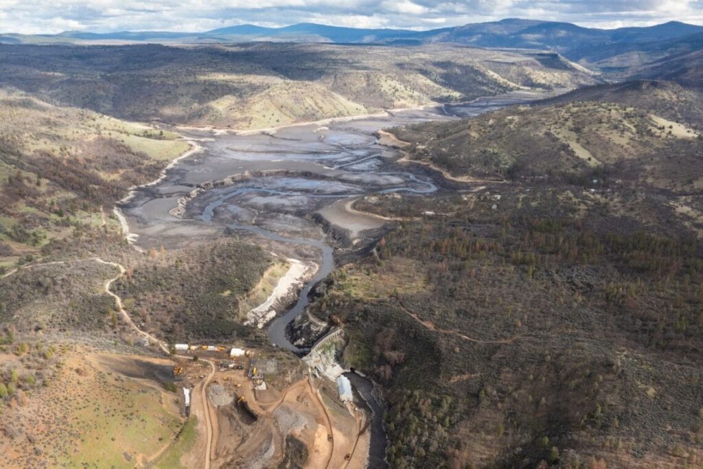
Klamath Reservoir Drawdowns: Short-term Costs for much larger long-term gains
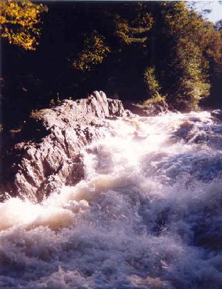
From American Whitewater3/28/2024
Wells River (VT) Whitewater Access to be Improved under New FERC License